LISCAD 20.2

Compile land survey data, draw maps and customize various resources
3.6 
Rating
Your vote:
Latest version:
20.2.17 See all
Developer:
LISTECH Pty. Ltd.
Screenshots
1 / 11
Awards (2)
Show all awards
Software Informer Editor Rating 4 Software Informer Virus Free award
Trusted Download
573 KB

LISCAD is a complex software solution capable of assisting specialists in compiling land survey data. It comes packed with lots of functions like rigorous geodetic computations, 2D and 3D transformations, or volume computations.

The installment can be done pretty easy though it does take several minutes to complete. Once you start it, you are greeted by a fairly basic interface, with pale colors and poorly crafted menus and icons. There are no theme options, but only some basic toolbar customizations.

Though it's interface is far from outstanding, the embedded features are nothing like it. They offer flexibility, allow users to do their job with ease, and unlike other similar utilities they don't require a deep learning curve.
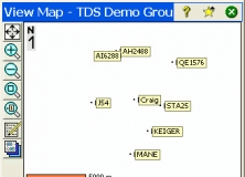
LISCAD provides the means to perform 3D visualization and volume computations. In addition, you have point clouds that can be imported, viewed, edited and utilized for virtual surveying workflows.
Above all that, users can customize code structure, projections, toolbars, fonts and other aspects of the system.

To conclude, LISCAD is a comprehensive software utility for performing visualizations and land data processing. Though it's easy to use, you should have minimal knowledge in this work field. It does have an above-average resource consumption and at times it may feel unresponsive, but still, you should give it try.

JS Senior editor
John Saunders
Editor rating:
rating

Review summary

Pros

  • Includes 2D and 3D transformations
  • Can perform geodetic computations
  • Has code structure customizations

Cons

  • Consumes lots of system resources
  • Feels unresponsive at times
  • Has poorly crafted menus and icons

Comments (1)

3.6
Rating
35 votes
5 stars
17
4 stars
4
3 stars
4
2 stars
3
1 stars
7
User

Your vote:

A
Ajith
The latest version is nicer and more useful than v.8.

Was it helpful?  yes(2) no(1) | Reply

Related software

Survey Pro Ranger DEMO
rating

It allows you to test an environment based on the Ranger Data Collector device.

Kamstrup MULTICAL (R) Module Programmer
Kamstrup MULTICAL Module
Free
rating

It enables you to configure communication addresses for Kamstrup devices.

Survey Import and Export
rating

The Survey Import and Export program works with AutoCAD.

Carlson Survey 2011
Carlson Survey 2011
rating

Carlson Survey 2011 comes with 64-bit capabilities, is Windows 7 compatible.

CalepiNum
CalepiNum
rating

A standalone facade layout and cladding piece of software.

Related suggestions

Liscad 6.2 free download
Liscad 10 free download
Liscad 8
Liscad 11.1
Download liscad 9.0
Liscad 12.0
Liscad 6.2 download
Liscad for windows 7 64 bit
Liscad 10 for windows 10

Tags

Data processing 3D visualization Land surveying Civil engineering Terrain profiles Survey processor Geographical maps Field surveying Earthworks volumes Terrain modelling